Stanly County, North Carolina, and it's Railroads
Railfan Stanly
Railfan, railfan, where do you see trains in Stanly County, North Carolina?
Frograil was set up to detail railfan locations in North America. In the Railfan Guide, over 4,100 sites are presented, but those locations within Stanly County, North Carolina, are presented differently. The emphasis is placed on allowing residents and visitors to explore some railfan locations I've selected on the basis of history, beauty, and/or today's activity.
A DeLorme North Carolina Atlas and Gazetteer will help you a lot, as some of these spots are off the beaten path. In giving you directions to sites, I'm assuming you've gotten one of the Stanly County maps available at Wal-Mart and drug stores, or have done pre-work on MapQuest. Note that the Stanly County Chamber of Commerce map has numerous errors, and doesn't even show all the railroads. It's a very poor map.
As you look at the map, remember that the NS ex-Southern/Yadkin comes down from Salisbury to Halls Ferry Junction and then goes over to Badin. The ACWR goes east-west from Norwood to Stanfield, and the WSSB comes down from High Rock Lake to go thru Albemarle and on to Wadesboro. So......., let's go.
Cities And Sites
- Albemarle -- Market Station
- Albemarle -- Rock Creek Park
- Albemarle -- Yadkin/WSSB Crossing
- Aquadale -- The Infamous Caboose
- Badin
- Halls Ferry Junction
- Norwood -- Historic Railroad Area
- Norwood -- Rocky River North
- Norwood -- WSSB/ACWR Interchange
- Norwood to Oakboro
- Oakboro
- Stanfield
- Stanfield -- A Surprise
- Tillery -- East Side
- Tillery -- NC-731 Bridge
- Tillery -- Portage Views
- Whitney
The WSSB station was built at the corner of Railroad Street and Old Charlotte Street. When I arrived in May of 1995, the station was not in particularly bad shape, but it was on the verge of going seriously downhill fast. Within the past several years, a few people with lots of vision and energy have done a major favor to Albemarle and railfans. Market Station has been created. The station was moved 2 blocks north and sited at the intersection of Main and Railroad Streets. This is a much more visible location. A very nice Farmers' Market structure was completed, and public restrooms were built. The station itself was completely rebuilt inside and out, and is now used for weddings, meetings, and the like. It seems to be very popular. It's an attractive, functional area, and the folks responsible can feel quite proud of what they've accomplished.
In conjunction with an Stanly County Preservation Society "do" at the Station, I was asked to speak on Stanly County and its Railroads. In doing so, it was of interest that I'd lived in Stanly County for less time than almost anyone in attendance, and yet I was telling them about THEIR railroads. Most seemed surprised at the profound impact those railroads had played on the growth of the county. The same is true in virtually all communities across the country.
From US-52 just south of the NC-24/27Bypass, take a right and go into Rock Creek Park, and then take the first left and drive down to the parking lot. Get out of the car and continue down this short road to the beginning of a trail. The trail is well-maintained and attractive. It is also flat and straight. The trail was constructed for you in 1891, but it was built to be a railroad. What railroad was this? Give up? This is the roadbed of the Yadkin going from Albemarle to Norwood, and only a mile of it is left. It would have made a wonderful rail-trail, but back in 1938 when it was abandoned, such things were undreamed of.
It's interesting to compare the massive, well-engineered 1910 roadbed of the WSSB (about 100' west) to this trail. One suspects that there must have been a lot of waterlogged sections of the line in wet weather.
Albemarle -- Yadkin/WSSB Crossing
From the busy US-52/NC-24/27 intersection on the southwest corner of town, go west (compass north) on US-52 to Old Salisbury Road. Take a right and go over the tracks. This is the Winston-Salem Southbound. You'll see 150' or so ahead of you a newly-paved short section of the street. This place was the crossing of the Yadkin/Southern. The tracks were torn up in 2002, although they'd not been used for several years before that. You can park on the north side of the street. Walk north on the tracks for another 150' or so, and you'll be at the site of the WSSB/Yadkin crossing. The diamonds were removed in about 2000. As you can see, this area is wide and flat (as opposed to almost every other speck of real estate in Albemarle), and was the site of a good-sized interchange and classification yard north of the textile mills and grain elevators just to the south.
Much of the very large Wiscasset Mill complex has been torn down in 2000-2002, and the old, mostly wooden grain elevator is in the process of being razed during the first half of 2002 -- a process that will continue well into 2003. It's getting to the point that it's harder and harder to visualize the torrent of 40' boxcars that must have stuffed this area in the 1950's and into the 1960's. In the vicinity of the crossing was a tower. At the risk of being redundant, here's a paragraph from the Stanly Railroad History page:
There was an interlocking tower in Albemarle, one of only 3 on the entire WSSB. The tower protected the crossing of the Yadkin and WSSB railroads, and had 8 levers used to align the switches in the area. It stood until 1968, when a Southern Railway train was switching some cars, and pushed them into the end of a WSSB train which was going over the crossing. Apparently, the caboose on the WSSB train was pushed into the tower, demolishing it pretty effectively. I believe the caboose was number 668, which today is stored in Aquadale, and may eventually become part of the station renovation taking place in Albemarle.
Unless you want to wait until the very, very early hours of the night, you'll not see the WSSB sail thru, but the historic impact and "feel" of this area makes the visit well worth it.
Aquadale -- The Infamous Caboose
South of Albemarle via NC-138 is the village of Aquadale. Just before crossing the tracks, turn right onto Stanly School Road. This will take you along the ACWR. There is a spur with a caboose parked upon it -- the crummy has been there for several years. It's windows have been broken out, but it's not really in terrible shape. So why is it infamous? This is WSSB #668, and go here to find out why it has a less than stellar railfan reputation.
Badin is the site of an Aluminum Company of America smelter, which ceased operations in the early 2000's. Alcoa received alumina and other raw materials by rail, but shipped aluminum ingots by truck. There were probably 40-60 carloads delivered in most weeks, with the majority coming from the NS via Halls Ferry Junction. Additionally, cars were exchanged at Whitney by the WSSB.
As of very late 2006 or very early 2007, Norfolk Southern no longer operates over the line from Halls Ferry Junction. A contract operator keeps an engine inside the Badin plant, and runs up to Whitney on an as-needed basis. The only traffic into the plant are boxcars with ingots. The plant "purifies" them for use such as aircraft, and then ships them out. I don't know if any ingots are shipped out via rail, but suspect virtually all completed ingots go out by truck.
The town of Badin is rather unique, in that it is apparently a "company town" from early in the 20th Century. The structures are different than those in any other town I've ever seen. Drive around a bit off Falls Road, and you'll see what I mean.
South of the town of New London, the ex-Yadkin goes due south and on into Albemarle. However, in 1916, when the Badin aluminum plant opened, the aluminum company built a line from the plant to a point which is today immediately south of and adjacent to today's North Stanly High School. Where it tied into the Yadkin was (and still is) called Halls Ferry Junction. I have no idea where the name came from, because there's no body of water anywhere near this point, but so be it. The area of and around the junction is the most important railroad point in Stanly County.
NS has a storage/switching siding south of the junction, and plastic pellet covered hoppers and dimensional lumber centerbeam flats are usually in evidence. See Operations for a more complete discussion of what happens here. Interestingly, the railroad that runs from Badin works to New Halls Ferry Junction, across the WSSB at Whitney, and on into Badin is still the property of Alcoa, not NS. Good pix are available at the junction itself, as well as from Random Drive, which is south of the junction, and is just south of the end of the siding.
Norwood -- Historic Railroad Area
The construction of the Yadkin from Albemarle to Norwood turned the latter into a bustling commercial center. In fact, starting in 1913, all three Stanly County railroads met just to the northwest of what is now downtown.There were stations, a roundhouse, freight sheds, and plenty of industrial and commercial activity. Today, all that's hard to believe. From US-52/Main Street, go southwest on either Andrews or Whitley streets. Just keep going downhill to the tracks. Try to imagine all the activity taking place in this relatively small area. It must have been something. Today, it's nothing.
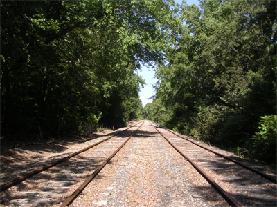
In my humble opinion, the prettiest part of Stanly County is just north of the Rocky River and Zion Church Road to the south of Norwood. You can walk north along the tracks (get permission from WSSB first, and make sure the early AM train has passed) for several miles and you won't see a house, a car, or (almost certainly) another human being. What you will see are fields, pastures, woods, and a beautiful, unspoiled part of our lovely county.
Norwood -- WSSB/ACWR Interchange(September 2006)
MP 345 - 346 on the ACWR. To visit this location and enjoy it, you'll need to have permission from the ACWR, as it involves walking railroad property. With the exception of Halls Ferry Junction, this is the most interesting railroad location in the county, although there are only a total of 6 trains a week thru here. This is a lovely and interesting walk, but there are no photographic locations. We will walk it timetable east to west, although much of the walk is compass northwest.
The walk starts in the north edge of the area that was the industrial area that was just west of the downtown area. There were stations, a roundhouse, and industrial activity in the area, but all that remains today are the crumbling remains of a feed mill, and a few small to medium sized industrial structures. However, as we start the walk, the first thing that we will see will bolster our optimism for the future.
From US-52 in Norwood, go southwest on Whitley Street. (It might help to bear in mind that Norwood is on a distinct northwest - southeast axis.) Park in the area of the tracks. Just northwest of the crossing, you'll see the MP345 sign. What you'll also see is a siding that has obviously been cleaned and upgraded for regular usage. You'll probably also see a string of empty hoppers in the siding. These cars are staged for the Stalite quarry in Aquadale. This staging capability is new, as the siding had been in a state of considerable disrepair prior to the recent past. We will cover the area southeast of Whitley Street at some future date. Start walking northwest!
There were 9 hoppers in the siding the day I visited (2 Sep 06), and there might be room for a 10th, but it would be very tight. A derail has been installed in the north end of the siding, and the switch is in excellent condition. Someone's been "workin' on the railroad". There are the vestigial remains of a road (Dock Street?) going into an industrial building in the vicinity of the switch, but it doesn't appear to be active. North of the switch, it's difficult to see where the second track (beyond where the switch is now located) may have been, but after 100' or so, the roadbed becomes wider than normal, suggesting that double track existed northwest to the out-of-service 2nd track northwest of here.
After the switch ending the siding for the stored hoppers, there is a stretch of about 100 yards or so, and then another switch begins a long siding heading all the way to the WSSB interchange. This one, however, is very different than the last one, as this is definitely out of service. Its points are spiked down, and it's probable that no movements have occurred over it for many years. There are few decent ties, little ballast, and even a 2 tie barricade along the way.
Even in the summer, with the trees in full leaf, you'll easily note the fence and cemetery off to your left as you walk further along. This is the part of the walk wherein you feel that you're in the middle of nowhere:
The left track is the main line, and the poor old secondary track is to the right. We are looking towards the northwest, and the railroad bends strongly to the west and the WSSB interchange at the top of the tracks visible in the photo. The picture was taken at the north end of the fence around the cemetery.
A little further northwest of the point from which the photo was taken, you'll see a paved road -- little more than a track -- to the right, well below track level. There is a small, visible electrical substation further east, and this is apparently a Town of Norwood or utility facility. At this point, look to the left, and you should see the remains of what was a road across the tracks. This was probably Old Road, but that is a guess. In the vicinity of the area where the road peters out before the tracks, you must be alert, as the local kids apparently go down there to drink beer. There are numerous reminders of their past indiscretions, and glass is very thick thru here.
As you get to the point where the big curve from northwest to west takes place, you'll notice you're on a high fill. As you walk around the curve, you'll soon see the high fill abruptly ending, and the remains of a substantial brickyard are on your left. One speculates that detritus from the yard filled in the difference between the bottom of the fill and the level land on your left. If you collect brick remnants, this is the place for you, as they are all around the area of the tracks. Do not venture into what was the brickyard, as it is overgrown, and it is difficult to interpret structure in the facility. The brickyard's remains will be on your left all the way to the crossing at Brickyard Road.
We now are in the beginning of the interchange with the Winston-Salem Southbound Railway. The siding's tracks will deteriorate even further, with several yards at a time having no ties. The worst point of the track work is just east of the switch. The switch is now used to get from the main to the WSSB interchange track, which will go off to the north. The switch and the interchange track are in good condition, and obviously well used. The distance between the switch leading to the WSSB interchange track, and the switch leading from the latter back to the ACWR main is only about 2-3 car lengths. On the ACWR main, there is a spur track leading to what was the loading dock at the brickyard, but the frog has been taken out of the switch, and it will be a long time before anything goes down that spur. Just after the spur's switch, the switch from the WSSB interchange track re-joins the ACWR main.
It is obvious that the WSSB interchange track was double track at one time, as there are substantial remains of ties present, and the roadbed is quite wide. The entire area of the interchange, from south of the brickyard area to the Brickyard Road crossing has been cleaned up, and is wide open. It's great to see that the freight traffic progress of the ACWR in recent years is paying off in a better physical plant.
Walk to the west and cross Brickyard Road, and you'll see the WSSB below you in a cut. Stay well back from the bridge, as it's a long ways down to the WSSB, and the rocks are not super stable throughout the area. Just east of the bridge you'll see the MP 346 marker (original Norfolk Southern Railway distance from Norfolk), and a "Begin Oakboro Block" sign.
Between Norwood and Oakboro, the ACWR gently meanders along at a restricted speed pace all the way. Want to take 40 pix of the same 1 engine, 5 car train? This is the place to do it. Here are a few of the crossings, east to west, starting in the western edge of Norwood: Riverview Road, Old Cottonville Road, Horne/Stanly School Road, Cottonville Road, Stanly School Road, Southern Road, NC-138, Old Aquadale Road, Bethlehem Church Road, Hazard Road ("The Route to Frog Pond"), Barbees Grove Road, NC-138, Richard Sandy Road, NC-742. We have just traveled maybe 5-6 miles, and have had innumerable ops to shoot pix. This is a great place to "chase" a train with a young grandchild.
If you drive thru Oakboro, you'll note that the "downtown" commercial buildings all look like they were built at the same time. They were, in large part. When the Norfolk Southern built thru on its way to Charlotte in 1913, it created towns where there had been none, and Oakboro was one such place. As prosperity came to the new town, so too came those "new" buildings. Oakboro is the post office that Frog Pond uses.
East of NC-742 is a short siding track that used to be used to load logs and unload grain. The siding hasn't been used for at least the past 7 years. However, a new spur has been put into the Locust Lumber dimensional lumber storage area. A miller has a seasonal operation across from the spur, and an engine will frequently lay over in the area of the miller.
Towards the western edge of the county, Stanfield was a town created when the (old) Norfolk Southern built from Mt. Gilead to Charlotte. Today, there are two customers, and one of them is important. The minor one, Talley Farms, is just to the east of NC-200, and it sees an occasional car, which is unloaded in the very nice unloading shed in evidence. To the west about 2 blocks is what's now Edwards (Banks?) Lumber Company, and it receives probably 6-8 loads a week of dimensional lumber on centerbeam flats. If you're a modeler or other railfan interested in freight cars, you can take pix of car after car after car here, and the chances are, you'll get nothing but unique types, reporting marks, and/or paint jobs. And remember, there are still, in the 2000's, carloads of lumber being shipped in 50' and 60' boxes.
Between the western edge of Stanfield and Renee Ford Road to the west, the countryside is attractive, and some fairly significant hills presage the Rocky River a little further west. While walking up one of those hills in the mid-1990's, I got a real surprise. The ACWR is a small, marginal local railroad, and even under Southern Railway ownership, it was never a great deal more. You can therefore imagine my surprise to find a section of track, maybe 1/4-1/2 mile long, laid on concrete ties!
Since the railroad never had any need for such heavy duty, expensive ties, it's a mystery as to why they're there. I think they must have been laid as a test of some sort, back when the concrete ties were being invented and evaluated. Those things are tremendously heavy, and will last longer than anyone alive in 2002 will be around.
South of the point where the Uwharrie River joins the Yadkin, the Yadkin suddenly becomes the Pee Dee River. In the southeast corner of Stanly County, this was a narrow, falls-strewn piece of river, and in 1926-1928, a dam was built to provide hydroelectric power to the region. It was known as the Norwood Dam until it was re-named for a Mr. Tillery, who was a Carolina Power & Light executive. The entire area is now known as Tillery, as is the impoundment lake itself.
The NC-731 highway bridge over the Pee Dee River gives a grand panorama from dead west - east over the bridge, and would be a terrific shot with a panorama lens/camera at almost any time of the day. You've got the rocky riverbed, the woods and hills on both sides, and the impressive, long railroad bridge right in front of the dam, which looms over the entire scene. It's really nice.
There is a broad shoulder over the bridge, but I'd suggest you get a couple of pix and then depart. The road is quite busy, including lots of big, fast trucks. You'll have to park off the bridge and walk out to the center for your shots.
There is terrific, easy to get to, view of the bridge coming out of Stanly County and crossing the Pee Dee River. Go east on NC-731 and cross the river into Montgomery County. The first paved road to the left is Hydro Road, and you should take it. Just before crossing the ACWR, take another left to go toward the river and dam. At the end of the public road (there is a gate leading to the dam and office -- don't even think about going thru that gate) there's an area for fishing and a rather rough boat put-in, and a small parking area for folks who want to fish or just enjoy the scenery.
Park and walk to the gate, then take a left to walk just by the fence. There is about 18-24" of flat "shelf" in front of the fence, and about 20-30' to the north along the fence is as good a railfan picture location as you're likely to find in most places. The thing to do is call the ACWR in Star, NC, and get an approximate time for the train coming out of Oakboro and Norwood heading for Star. If you can get an approximate time, you'll probably still have to get there early and wait awhile, but the result should be worth it -- one engine and 2-5 cars on a massive bridge with the best scenic views all around. Be alert, though, because the river and dam are fairly noisy, and it would be a shame to miss your picture.
When you're driving down to the river along the entrance road, you'll notice the remains of the railroad spur that came from the (original) Norfolk Southern down to the dam construction area. You railroad historians will want to check out the rail. It appears to be 65lb. (?) rail, and it was made in 1892. It's interesting to see 114-year-old rail still on a roadbed.
For you combat railfans, there's an interesting way to get a good overview of the Tillery Hydroelectric Dam, the Pee Dee River, and the ACWR bridge over the river. The last left (north) turn off NC-731 before it crosses the river is Hydro Road. Don't confuse it with the Hydro Road to the east, in Montgomery County. Take Hydro, cross the ACWR, and drive to the end and park. As you can see, you're at the extreme west end of the dam. There's a big chain link fence that, about 20' south of the gate, takes a 90° turn to go east towards the river. There is a small sign at that turn that indicates this is a portage trail. For those intrepid souls who are canoeing up or down the river, this trail gets you up from the river to the impoundment lake, and vice versa.
Take a good look down the trail (and I mean down, as in down, down, down), and you'll see the railroad bridge off to your right. Walk down the trail and it will bend more to the south. There are a few spots for decent pix of the bridge, but you've got to get away from or higher than that heavy chain link fence. Winter is the best time of year, but don't try it during hunting season -- do it after January 1st.
From back where you parked, you can use the remains of the old road to the south to get to the railroad and walk along the roadbed to the trestle, but the view is disappointing, as you've lost your sense of perspective. Also, you've got to blatantly trespass to walk the roadbed, and that's not only dangerous, it's probably stupid after 9-11.
This is a pretty cool place, but don't expect the amazing traffic you would have seen 90 years ago (see History). With the removal of the crossing in Albemarle, Whitney now is the last active railroad crossing in the county. As of very early 2007 or very late 2006, Norfolk Southern ceased service over the Halls Ferry line. A contract operator was working the little remaining traffic in and out of the Badin plant.
Since even the DeLorme NC atlas doesn't show Whitney, here's how to get there: From NC-740 going north from Badin, take a right on Old Whitney Road, and just keep going and going until you run out of road. This will be the Whitney boat put-in. Park in the far southeast corner of the parking lot. Walk all of 10' south to the tracks (the NS-leased line going into Badin) and walk to the left along the tracks to the diamond with the WSSB. There is an interchange siding just south of the diamond, and it's irregular not to see at least one car here during the week.
In how many railfan locations can you be a perch jerker, put your bass boat in, and see the local come in and out of an industrial facility? I think Whitney is something else.
Update:April 2010. The Winston-Salem Southbound Railway is using a lot of the Alcoa tracks for car storage, but those cars will probably be drawn down as the recession slowly gets behind us.